Welcome to the Pepper Ridge North Valley's
Severe Weather Page
This is your weather warning resource page. Check this page for the latest watches and warning updates,
from The National Weather Service, Phoenix, Az.!
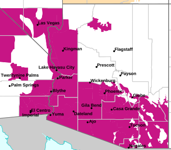
MAP OF CURRENT SOUTHWEST WATCHES, WARNINGS AND ADVISORIES
Local & Regional Weather Statements, Watches And Warnings
Weather Alerts for Globe/Miami/SuperiorIssued by the National Weather Service |
 FLOOD WATCH |
| GLOBE/MIAMI/SUPERIOR |
Areas Affected:
New River Mesa - Rio Verde/Salt River - Superior - Tonto Basin - Mazatzal Mountains - Pinal/Superstition Mountains - San Carlos - Dripping Springs - Globe/Miami - Southeast Gila County |
| Effective: Sun, 11/1 12:41am |
Updated: Sun, 11/1 3:11am |
Urgency: Future |
| Expires: Sun, 11/1 3:00pm |
Severity: Severe |
Certainty: Possible |
|
Details:
* WHAT...Flash flooding caused by excessive rainfall continues to be
possible.

* WHERE...A portion of south central Arizona, including mainly
Southern Gila County.

* WHEN...Through late tonight.

* IMPACTS...Excessive runoff may result in flooding of rivers,
creeks, streams, and other low-lying and flood-prone locations.
Low-water crossings may be flooded.

* ADDITIONAL DETAILS...
- An atmospheric river ahead of a weather system will continue to
bring well above normal moisture to the region through today and
lead to a prolonged period of light to moderate rainfall across
the Watch area. Embedded convection will produce pockets of
heavier rain. Additional rainfall amounts, on the order of 2-4+",
through the course of Sunday on top of already moist soils, will
lead to additional runoff. Runoff in major streams, creeks, and
rivers may persist through the first half of the week.
- http://www.weather.gov/safety/flood
Information:
You should monitor later forecasts and be prepared to take action
should Flash Flood Warnings be issued. |
Key to Icons for Local & Regional Weather Statements, Watches And Warnings

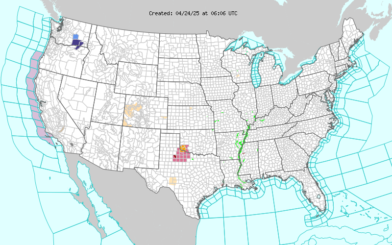
Map of the Current Watches, Warnings, and Advisories Nationwide:
|
|
Member of the:


|
North Valley Random Weather Facts |
DEW POINT
Dew point is the temperature to which air must be cooled for saturation (100% relative humidity) to occur. The dew point is an important measurement used to predict the formation of dew, frost, and fog. If dew point and temperature are close together in the late afternoon when the air begins to turn colder, fog is likely during the night. Dew point is also a good indicator of the air's actual water vapor content, unlike relative humidity, which takes the air's temperature into account. High dew point indicates high vapor content; low dew point indicates low vapor content. In addition a high dew point indicates a better chance of rain and severe thunderstorms. You can even use dew point to predict the minimum overnight temperature. Provided no fronts or other weather pattern changes are expected overnight, the afternoon's dew point gives you an idea of what minimum temperature to expect overnight.
Get the Facts PHP
|
|
Page layout last updated on Mar 8th, 2024
|
|
|


 New Feature