Welcome to the Pepper Ridge North Valley's
Severe Weather Page
This is your weather warning resource page. Check this page for the latest watches and warning updates,
from The National Weather Service, Phoenix, Az.!
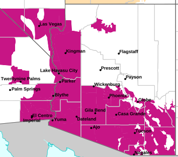
MAP OF CURRENT SOUTHWEST WATCHES, WARNINGS AND ADVISORIES
Local & Regional Weather Statements, Watches And Warnings
Weather Alerts for Gila CountyIssued by the National Weather Service |
 FLOOD WARNING |
| GILA COUNTY |
Areas Affected:
Gila, AZ |
| Effective: Sat, 10/31 10:26pm |
Updated: Sun, 11/1 3:11am |
Urgency: Expected |
| Expires: Mon, 11/2 8:00am |
Severity: Severe |
Certainty: Likely |
|
Details:
* WHAT...Flooding caused by excessive rainfall is expected.

* WHERE...Gila County in east central Arizona...

* WHEN...Until 800 AM MST Monday.

* IMPACTS...Flooding of Tonto Creek and flood-prone locations is
occurring. Low-water crossings are inundated with water and may not
be passable. Tonto Creek is expected to continue to slowly rise
over the next 12-24 hours.

* ADDITIONAL DETAILS...
- At 1026 PM MST, a streamflow gauge on Tonto Creek north of Tonto
Basin is above action stage, with a stage height of 4.38 feet at
915 PM MST. Flooding is ongoing along Tonto Creek in the warned
area. Please use the Tonto Creek Bridge for all travel across the
creek. Bar X Crossing, and any other low water crossings, will
likely become impassable.
- Some locations that will experience flooding include...
Tonto Basin.
- http://www.weather.gov/safety/flood
Information:
Turn around, don't drown when encountering flooded roads. Most flood
deaths occur in vehicles.

Be aware of your surroundings and do not drive on flooded roads. |
 FLOOD ADVISORY |
| GILA COUNTY |
Areas Affected:
Apache, AZ - Gila, AZ - Navajo, AZ |
| Effective: Sun, 11/1 1:33am |
Updated: Sun, 11/1 3:11am |
Urgency: Expected |
| Expires: Sun, 11/1 8:30am |
Severity: Minor |
Certainty: Likely |
|
Details:
* WHAT...Flooding caused by excessive rainfall is expected.

* WHERE...Gila County in east central Arizona...
Navajo County in north central Arizona...
Apache County in northeastern Arizona...

* WHEN...Until 830 AM MST Sunday.

* IMPACTS...Minor flooding in creeks and normally dry washes is
imminent or occurring. Water flowing over roadways will create
slick roads and muddy unpaved roads.

* ADDITIONAL DETAILS...
- At 133 AM MST, Doppler radar indicated heavy rain due to
thunderstorms. Minor flooding is ongoing or expected to begin
shortly in the advisory area. Between 0.25 and 1 inch of rain has
fallen.
- This includes the following creeks, washes and rivers...
Corduroy Creek, Sepulveda Creek, Linden Draw, East Cedar Creek,
Thompson Creek, Cottonwood Canyon, Porter Creek, Gooseberry
Creek, Rocky Arroyo, Hog Wash, Brown Creek, Cedar Creek, North
Fork White River, Carrizo Creek, Show Low Creek, Dodson Wash,
Silver Creek, Hay Hollow Draw, Bear Canyon, Billy Creek, Walnut
Creek, Forestdale Creek, Pulcifer Creek and Turkey Canyon.
Additional rainfall amounts of 1 to 1.5 inches are expected over
the area. This additional rain will result in minor flooding.
- Some locations that will experience flooding include...
Show Low, Pinetop-Lakeside, Lake of the Woods, White Mountain
Lake Estates, Linden, Wagon Wheel, North Fork, Pinetop Country
Club, McNary, Cedar Creek, Carrizo, Rainbow Lake, Indian Pine,
Hon-Dah, Show Low Regional Airport, White Mountain Apache
Reservation, Show Low Lake, Red Top Mountain and Woodland
Reservoir.
- This includes the following highways...
State Route 260 between mile markers 331 and 361. Highway 60
between mile markers 298 and 357. State Route 73 between mile
markers 311 and 326...and between mile markers 353 and 357. State
Route 61 between mile markers 353 and 356. State Route 77 between
mile markers 343 and 352.

This includes the following recreation areas andcampgrounds...
Scott Reservoir Campground, Fool Hollow Lake Recreation Area
Campground, Los Burros Campground, Brown Creek Campground,
Lakeside Campground and Los Burros Campground.
- Additional information is available at weather.gov/flagstaff.
Information:
Be aware of your surroundings and do not drive on flooded roads.

Low water crossings will become dangerous in heavy rain. Do not
attempt to cross flooded roads. Find an alternate route. |
| FLOOD ADVISORY |
| GILA COUNTY |
Areas Affected:
Gila, AZ - Pinal, AZ |
| Effective: Sun, 11/1 2:56am |
Updated: Sun, 11/1 3:11am |
Urgency: Expected |
| Expires: Sun, 11/1 7:00am |
Severity: Minor |
Certainty: Likely |
|
Details:
* WHAT...Flooding caused by excessive rainfall is expected.

* WHERE...Gila County in east central Arizona...
Pinal County in southeastern Arizona...

* WHEN...Until 700 AM MST.

* IMPACTS...Minor flooding in low-lying and poor drainage areas.
Rises in small streams and normally dry arroyos.

* ADDITIONAL DETAILS...
- At 256 AM MST, Doppler radar and automated rain gauges indicated
moderate to at times heavy rain in the warned area. Minor
flooding is ongoing or expected to begin shortly in the advisory
area. Between 0.5 and 2 inches of rain have fallen over the last
6 hours.
- Additional rainfall amounts of 0.5 to 1.5 inches are expected
within portions of the area over the next several hours. This
additional rain will result in minor flooding.
- Some locations that will experience flooding include...
Globe, Superior, Miami, Top Of The World, Top-Of-The-World,
Claypool, Central Heights-Midland City, Boyce Thompson Arboretum
and Inspiration.
- http://www.weather.gov/safety/flood
Information:
Turn around, don't drown when encountering flooded roads. Most flood
deaths occur in vehicles.

Be especially cautious at night when it is harder to recognize the
dangers of flooding.

Please report observed flooding to local emergency services or law
enforcement and request they pass this information to the National
Weather Service when you can do so safely. |
 FLOOD WATCH |
| GILA COUNTY |
Areas Affected:
Kaibab Plateau - Marble and Glen Canyons - Grand Canyon Country - Coconino Plateau - Yavapai County Mountains - Northeast Plateaus and Mesas Hwy 264 Northward - Chinle Valley - Chuska Mountains and Defiance Plateau - Little Colorado River Valley in Coconino County - Little Colorado River Valley in Navajo County - Little Colorado River Valley in Apache County - Western Mogollon Rim - Eastern Mogollon Rim - White Mountains - Northern Gila County - Yavapai County Valleys and Basins - Oak Creek and Sycamore Canyons - Black Mesa Area - Northeast Plateaus and Mesas South of Hwy 264 |
| Effective: Sat, 10/31 11:14pm |
Updated: Sun, 11/1 3:11am |
Urgency: Future |
| Expires: Sun, 11/1 7:15am |
Severity: Severe |
Certainty: Possible |
|
Details:
* WHAT...Flash flooding caused by excessive rainfall over saturated
soils.

* WHERE...All of northern and central Arizona.

* WHEN...Through late Sunday night.

* IMPACTS...Flash flooding will be possible in creeks, normally dry
washes, swimming holes, and over recently burned areas. Low-water
crossings may be flooded.

* ADDITIONAL DETAILS...
- Rain and isolated thunderstorms are expected Saturday night
through the early morning hours of Monday. An additional 1 to 4
inches of rain will be possible, on already saturated ground.
- Additional information is available at weather.gov/flagstaff.
Information:
Have a way to receive Flash Flood Warnings and be prepared to take
action should warnings be issued.

Consider changing your plans if you were going to hike, boat, or
paddleboard to a slot canyon or normally dry wash. If you do still
decide to recreate, check in at a nearby visitor center or ranger
station. |
| FLOOD WATCH |
| GILA COUNTY |
Areas Affected:
New River Mesa - Rio Verde/Salt River - Superior - Tonto Basin - Mazatzal Mountains - Pinal/Superstition Mountains - San Carlos - Dripping Springs - Globe/Miami - Southeast Gila County |
| Effective: Sun, 11/1 12:41am |
Updated: Sun, 11/1 3:11am |
Urgency: Future |
| Expires: Sun, 11/1 3:00pm |
Severity: Severe |
Certainty: Possible |
|
Details:
* WHAT...Flash flooding caused by excessive rainfall continues to be
possible.

* WHERE...A portion of south central Arizona, including mainly
Southern Gila County.

* WHEN...Through late tonight.

* IMPACTS...Excessive runoff may result in flooding of rivers,
creeks, streams, and other low-lying and flood-prone locations.
Low-water crossings may be flooded.

* ADDITIONAL DETAILS...
- An atmospheric river ahead of a weather system will continue to
bring well above normal moisture to the region through today and
lead to a prolonged period of light to moderate rainfall across
the Watch area. Embedded convection will produce pockets of
heavier rain. Additional rainfall amounts, on the order of 2-4+",
through the course of Sunday on top of already moist soils, will
lead to additional runoff. Runoff in major streams, creeks, and
rivers may persist through the first half of the week.
- http://www.weather.gov/safety/flood
Information:
You should monitor later forecasts and be prepared to take action
should Flash Flood Warnings be issued. |
Key to Icons for Local & Regional Weather Statements, Watches And Warnings

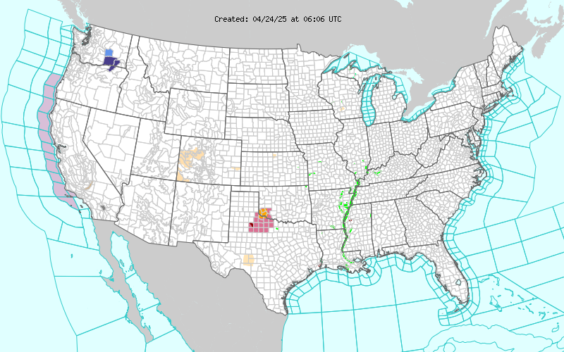
Map of the Current Watches, Warnings, and Advisories Nationwide:
|
|
Member of the:


|
North Valley Random Weather Facts |
HABOOB
The name comes from the Arabic word habb, meaning "wind." A Haboob is a giant wall of dust sometimes 3000ft tall,that travels a 40mph+, they frequently form here in Arizona from the gust front outflow boundary of summer thunderstorms. Haboobs are most frequent in Southwestern North America during the months of May through September, with the most frequent occurrence in late June, but they can occur in every month. (A picture of a classic Haboob appears on our Monsoon Page.)
Get the Facts PHP
|
|
Page layout last updated on Mar 8th, 2024
|
|
|


 New Feature