Forecast Discussion for HFO NWS Office
599
FXHW60 PHFO 170606
AFDHFO
Area Forecast Discussion
National Weather Service Honolulu HI
806 PM HST Thu Apr 16 2026
.SYNOPSIS...
High pressure passing to our north will bring a brief of moderate
to locally breezy easterly trade winds from Friday afternoon into
Saturday. Isolated thunderstorms will be possible near Kauai (low
confidence) and also for the Big Island slopes (moderate
confidence) on Friday afternoon. From this weekend into early
next week, a series of low pressure systems passing just north of
the state will produce southeasterly winds, along with increased
shower chances over the western islands.
&&
.SHORT TERM UPDATE...
Issued at 800 PM HST Thu Apr 16 2026
Forecast remains on track for another mostly dry day across the
state for Friday with a few exceptions. A weak upper level short-
wave trough moving through the area on Friday will bring an
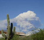
increase of cloud cover and will provide some instability for some
isolated thunderstorms over the slopes of the Big Island
(moderate confidence) and possibly over Kauai (low confidence), if
Kauai is able to get enough day time heating. Otherwise, we
should see mostly dry conditions on Friday with an increase of mid
to upper level clouds. Trade winds will also be filling in a bit
more and could become moderate to locally breezy by Friday
afternoon.
&&
.DISCUSSION... Issued at 403 PM HST Thu Apr 16 2026
Surface observations and a late morning advanced scatterometer
pass revealed light to moderate easterly winds returning to the
region today. Latest surface analysis shows that a trough is
currently located about 130 miles north of Kauai, associated with
a low pressure system that is now over 1600 miles northeast of the
state. Though trades are gradually returning, they remained light
enough today to support afternoon sea breezes, along with
increased clouds and showers over select island interiors. In
addition, afternoon satellite and radar imagery shows that mid-
and high clouds associated with the subtropical jet continue to
stream over the eastern half of the state. A few lightning strikes
were detected on GOES GLM (Geostationary Lightning Mapper)
imagery this afternoon, but rainfall has been sparse and light
statewide today.
High pressure building far to the northwest will quickly slide
eastward over the next couple of days. This will mark a short-
lived return to moderate easterly trade winds from tonight into
the weekend. These moderate trades will likely be strong
enough to limit sea breeze development to terrain sheltered areas
of the islands. However, a disturbance aloft is expected to
develop northwest of the state, and Kauai (along with its coastal
waters) may be close enough in proximity to this feature to see
increased showers and some isolated thunderstorm chances on
Friday. In addition, daytime heating could also spark afternoon
convection along the Big Island slopes. With this afternoon`s
forecast updates, isolated thunderstorms have been added for these
two areas on Friday, with the central islands remaining drier.
By Saturday, winds will start to veer a bit more east-southeast
as a low develops to our northwest, and eventually more southeast
to southerly by Sunday. This southerly flow will draw moisture
northward in the vicinity. As previous discussions have mentioned,
as of now the low appears to track far enough north to limit
heavy rain potential over the islands, though increasing
instability and shower chances are possible during the second half
of the weekend and into the first of next week. While moisture
availability appears to be a limiting factor at this time, upper
troughing (and an eventual upper low) developing over the state,
at least some modest vertical motion, and cooling temperatures
aloft warrant keeping an eye on the forecast from this weekend
into early next week.
&&
.AVIATION...
Issued at 800 PM HST Thu Apr 16 2026
Light to moderate easterly trade winds are gradually settling in
tonight and will maintain steady through tomorrow. An upper level
disturbance may provide additional showers to Kauai tomorrow
afternoon with isolated thunderstorms possible. Otherwise,
expect passing showers over windward and mountain areas, as well
as afternoon showers over kona slopes remain. MVFR conditions
may occur within showers and VFR elsewhere.
No AIRMETs are in effect.
&&
.MARINE...
Issued at 800 PM HST Thu Apr 16 2026
Trough to the NW maintains gentle to moderate easterly trades
through today. The strongest breezes will occur through the
typical windy channels surrounding Maui and the Big Island.
Building high pressure then supports moderate to locally fresh
easterly trades across the waters Friday into Saturday. Winds may
briefly reach the Small Craft Advisory threshold late Friday
through Saturday. Low pressure to our NW on Sunday will cause
trades to weaken slightly and veer to ESE. Gentle to moderate ESE
winds are expected Sunday into early next week.
Small background energy from the W will be possible this weekend
into next week from Typhoon Sinlaku, but confidence remains low. A
moderate NW to WNW swell is possible towards the second half of
next week as Typhoon Sinlaku transitions to extratropical early
next week. Low pressure advancing S along the W coast of the US
next week should produce a moderate, medium period NE swell
toward the islands by midweek.
A small to moderate, medium-period, SSE swell boosts surf along S
shores through Friday then lowers over the weekend. Surf is
expected to return to background levels along south facing shores
by early next week. Surf along E shores remains below the
seasonal average as trades remain light. However, increasing
trades by week`s end should bring a slight bump to surf over the
weekend.
&&
.HFO WATCHES/WARNINGS/ADVISORIES...
None.
&&
$$
Update...Kino
DISCUSSION...Vaughan
AVIATION...JT
MARINE...Kino
NWS HFO Office Area Forecast Discussion
|

 New Feature