SUNRISE MTN RIDGE'S 7 DAY DETAIL FORECAST FOR TUCSON FOOTHILLS, AZ.
National Weather Service Forecast for:
Catalina Foothills, AZ
Issued by: National Weather Service NWS Tucson Arizona
Updated: 2:58 am MST Nov 02, 2026
Sunrise Mtn Ridge Tucson Az
Today
Sunny
Tuesday
Sunny
Wednesday
Sunny
Thursday
Sunny
Friday
Sunny
Saturday
Sunny
Sunday
Sunny
Hi 71 °F
Hi 78 °F
Hi 79 °F
Hi 79 °F
Hi 76 °F
Hi 78 °F
Hi 79 °F
Tonight
Mostly Clear
Tuesday Night Mostly Clear
Wednesday Night Mostly Clear
Thursday Night Mostly Clear
Friday Night Mostly Clear
Saturday Night Mostly Clear
Sunday Night Mostly Clear
Lo 47 °F
Lo 51 °F
Lo 51 °F
Lo 52 °F
Lo 51 °F
Lo 51 °F
Lo 52 °F
Today
Sunny. High near 71, with temperatures falling to around 67 in the afternoon. West wind 3 to 7 mph.
Tonight
Mostly clear, with a low around 47. East northeast wind around 2 mph.
Tuesday
Sunny, with a high near 78. Southeast wind around 5 mph.
Tuesday Night
Mostly clear, with a low around 51. East northeast wind around 3 mph.
Wednesday
Sunny, with a high near 79. Southwest wind 2 to 6 mph.
Wednesday Night
Mostly clear, with a low around 51.
Thursday
Sunny, with a high near 79.
Thursday Night
Mostly clear, with a low around 52.
Friday
Sunny, with a high near 76.
Friday Night
Mostly clear, with a low around 51.
Saturday
Sunny, with a high near 78.
Saturday Night
Mostly clear, with a low around 51.
Sunday
Sunny, with a high near 79.
Sunday Night
Mostly clear, with a low around 52.
Forecast from NOAA-NWS
for Catalina Foothills, AZ.
Tucson, Az - Area Forecast Discussion
Forecast Discussion for TWC NWS Office
593
FXUS65 KTWC 020917
AFDTWC

Area Forecast Discussion
National Weather Service Tucson AZ
217 AM MST Mon Nov 2 2026

.SYNOPSIS...Some lingering shower activity will persist this
morning, then drier air moves in for the remainder of the work
week. High temperatures this week will be below normal for early
November.

&&

.DISCUSSION...The last part of the weekend atmospheric river/heavy
rain event is pushing through early this morning with light to
moderate rain as the upper level trof and associated cold front
pushes to the east-southeast. Most of this shower activity will
be over by 9 am. The heavy rain this weekend has led to some
significant rises on some of our mainstem rivers, creeks and
washes. See hydro section below for additional details.

Dry for the rest of the week into the weekend. Weak ridging moves
through on Tuesday, then westerly flow on Wednesday as a system
moves through the Great Basin. Weak trofiness remains over the
area Thursday and Friday with upper level ridging building in
this weekend.

Highs today will run 5 to 15 degrees below normal. Highs Tuesday
through this upcoming weekend will mostly run 3 to 8 degrees
below normal.

&&

.AVIATION...Valid through 03/12Z.
A band of -SHRA with MVFR cigs/isold IFR cigs and MTN OBSCN is
associated with a cold front moving to the east-southeast. Most
of this activity will be done by 02/16z. Thereafter SCT 070-090
AGL thru 03/00z, then becoming SKC by 03/06z. SFC winds mostly
NW 5-10 kts with ocnl gusts to 20 kts this morning. Light
terrain driven winds after 03/03z. Aviation discussion not
updated for TAF amendments.

&&

.FIRE WEATHER...Showers will gradually end this morning with
dry conditions the rest of the day. Dry conditions will continue
through the rest of the work week. Afternoon high temperatures
will be below normal through the forecast period. Northwest winds
today then typical winds for the remainder of the week. Minimum
RH levels values this week mostly between 35 and 50 percent.

&&

.HYDROLOGY...Rainfall of the past 48-72 hours led to some pretty
good rises on most of the main stem rivers and creeks. Although
most levels are holding steady or are slowly receding, the
immediate concern right now is the Gila River at Solomon where
Major flooding is forecast to occur late this morning where it
is expected to rise to 28.4 feet. Flood stage is 19.8 feet. A
Flood Warning is in effect until this evening.

&&

.TWC WATCHES/WARNINGS/ADVISORIES...
 Flood Watch until 5 AM MST early this morning for AZZ501>515.

&&

$$

Visit us on Facebook, X, YouTube, and at weather.gov/Tucson
Local & Regional Weather Statements, Watches And Warnings
Weather Alerts for Pinal County
Issued by the National Weather Service
FLOOD WARNING
PINAL COUNTY
Areas Affected: Pima, AZ - Pinal, AZ
Effective: Mon, 11/2 10:52am
Updated: Mon, 11/2 11:20am
Urgency: Immediate
Expires: Tue, 11/3 3:00am
Severity: Severe
Certainty: Likely
Details:
* WHAT...Small stream flooding caused by excessive rainfall
continues.

* WHERE...Northeastern Pima County in southeastern Arizona...
Southwestern Pinal County in southeastern Arizona...

* WHEN...Until 300 AM MST Tuesday.

* IMPACTS...The Santa Cruz River in Marana remains near minor flood
stage this morning and this flow will continue downstream later
today into tonight towards Sunland Gin Rd at the Greene Wash in
Pinal County.

* ADDITIONAL DETAILS...
- At 1049 AM MST, local law enforcement reported flooding at Trico
Rd and the Santa Cruz River near Marana.
- This includes the following streams and drainages...
Santa Cruz River, Greene Wash and Los Robles Wash.
- Some locations that will experience flooding include...
Marana.
- http://www.weather.gov/safety/flood
Information:
Turn around, don't drown when encountering flooded roads. Most flood
deaths occur in vehicles.

Be aware of your surroundings and do not drive on flooded roads.
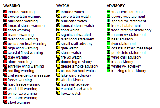
Key to Icons for Local & Regional Weather Statements, Watches And Warnings
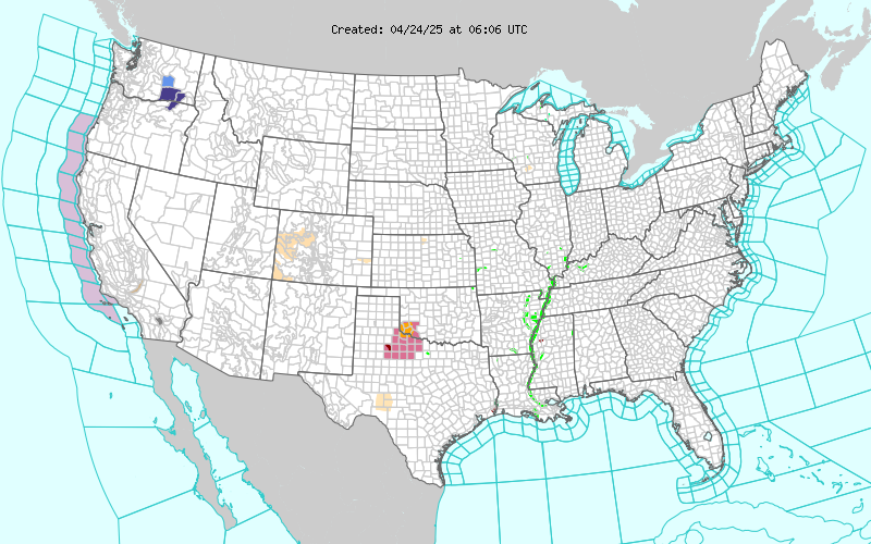
Map of the Current Watches, Warnings, and Advisories Nationwide:


 FLOOD WARNING